The Founding of the Round City of Baghdad
Al-Mansur lays out Madinat al-Salam, 145 AH
145 AH / 762 CE
 Educational historical reconstruction
Where
The west bank of the Tigris, the site of the Round City (Madinat al-Salam)
33.3550, 44.3500 · View on OpenStreetMap
Background
In 145 AH (762 CE) the second Abbasid caliph, Abu Ja'far al-Mansur, founded a new capital on the west bank of the Tigris and named it Madinat al-Salam, the City of Peace, the city the world would know as Baghdad. The Abbasids, victors of the revolution that had toppled the Umayyads, would not rule from Umayyad Damascus; al-Mansur sought a site at the heart of Iraq, between the Tigris and the Euphrates, where canals, river traffic, and the great roads of the empire met, with a climate and a food-supply to sustain a capital. He chose a plan unique among the cities of Islam: the Round City (al-Mudawwara), laid out as a perfect circle with a double ring of fired-brick walls and a deep moat, pierced by four equidistant gates set to the cardinal directions and each named for the land it faced and the road that ran to it, the gates of Kufa, Basra, Syria (al-Sham), and Khurasan. At the centre, in a great open court, stood the caliph's palace, the Golden Gate (Bab al-Dhahab) crowned by a green dome, and beside it the congregational mosque; between the centre and the walls lay the rings of streets and quarters. The sources describe al-Mansur having the plan traced on the ground in lines of ash and walking the circuit before the work began, and his astrologers, among them the astronomer Mashallah, electing an auspicious date for the foundation, a sign of the Persian and scientific culture the Abbasid court was drawing in. Within a generation Baghdad would become the largest city of the world outside China and the centre of a brilliant age of learning. The foundation is preserved above all in al-Khatib al-Baghdadi's history of the city and in al-Tabari, with the later geographers Yaqut and al-Muqaddasi. Nothing of the Round City survives above ground; its plan is known only from these descriptions. Workers build a curved brick enclosure beside a river. This compressed construction scene suggests the famous round plan but cannot show the capital at its historical scale.
What you see
A great slow river runs across a flat alluvial plain of date palms, with canals branching off toward a second river beyond, the Tigris in the Mesopotamian heartland, the well-watered site chosen for a capital, not a desert or a mountain valley.
Workers build a curved brick enclosure beside a river. This compressed construction scene suggests the famous round plan but cannot show the capital at its historical scale.
Historical descriptions name four gates: Kufa, Basra, Syria and Khurasan. Four monumental gateways cannot be identified in this image.
Brick stacks, tools and unfinished wall courses make a building project legible in a river landscape.
The central palace and mosque belong to the recorded plan of Baghdad. They are historical context, not identifiable completed buildings in this view.
Black banners fly over the work, the rayat al-sud of the Abbasids, the victors of the revolution, building their own capital rather than ruling from the white-bannered Umayyads' Damascus.
The visible work is manual construction. Accounts of astrologers choosing the foundation time do not establish an astrolabe or chart in the panorama.
Primary sources
al-Tabari, Tarikh al-Rusul wa-al-Muluk (early 10th c.): Principal Sunni narrative history. Preserves the account of the founding in 145 AH, al-Mansur's choice of site, the tracing of the plan, and the role of the astrologers. Confidence high for the sequence.
Further reading & cross-references
al-Khatib al-Baghdadi, Tarikh Baghdad (11th c.): The great Sunni history of Baghdad, opening with a detailed topographical description of the Round City and its foundation by al-Mansur. The principal Sunni source for the plan, the gates, and the building. Confidence high.
Yaqut al-Hamawi, Mu'jam al-Buldan (13th c.): The great Sunni geographical dictionary. Used for the description and naming of the Round City and its gates, drawing on earlier sources. Confidence high for the topography.
al-Muqaddasi, Ahsan al-Taqasim fi Ma'rifat al-Aqalim (10th c.): Sunni geographer. Used as a cross-reference for the layout and significance of the capital in the wider description of the Islamic lands. Confidence medium-high.
Jacob Lassner, The Topography of Baghdad in the Early Middle Ages (1970): Modern academic reconstruction of the Round City from the textual sources, since nothing survives above ground. Used for the critical reconstruction of the plan and the gates. Confidence high.
Hugh Kennedy, When Baghdad Ruled the Muslim World / The Court of the Caliphs (modern): Modern non-confessional synthesis. Used for the strategic reasoning behind the site, the design, and the meaning of the new capital for the Abbasid age. Confidence high.
Questions & answers
- Where is The Founding of the Round City of Baghdad?
- The west bank of the Tigris, the site of the Round City (Madinat al-Salam)
- When did it happen?
- 145 AH / 762 CE
- What is the story of The Founding of the Round City of Baghdad?
- In 145 AH (762 CE) the second Abbasid caliph, Abu Ja'far al-Mansur, founded a new capital on the west bank of the Tigris and named it Madinat al-Salam, the City of Peace, the city the world would know as Baghdad. The Abbasids, victors of the revolution that had toppled the Umayyads, would not rule…
Related places

Tigris Shore After the Sack of Baghdad
656 AH / 1258 CE

The Mustansiriyya Madrasa
631 AH / 1234 CE

The House of Wisdom
c. 215 AH / 830 CE
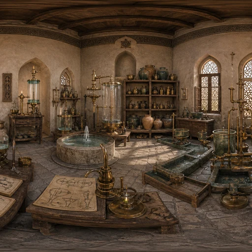
The Banu Musa and the Ingenious Devices
c. 236 AH / 850 CE

The Mihna and the Stand of Imam Ahmad
The Mihna (218-234 AH / 833-848 CE)

The Fall of Ctesiphon
16-21 AH / 637-642 CE
Guess places like this in GeoSiyer
Drop into a 360° scene from Islamic history and pin where, and when, it happened.
Play GeoSiyer